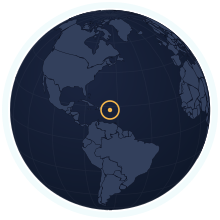
US Virgin Islands at its true size
US Virgin Islands covers 346 km², number 206 of 235 countries and territories by area. Home to 103,792 people (2025). Sitting near the equator, it is one of the few places Mercator gets almost right.
Equal-area projection · Natural Earth 50m
| Area | 346 km² Wikidata |
|---|---|
| Population | 103,792 World Bank, 2025 |
| Density | 300 per km² |
| Capital | Charlotte Amalie |
| Local time in Charlotte Amalie | |
| Time zone | UTC−4 IANA |
| Currency | United States dollar (USD) Wikidata |
| Languages | English |
| Traffic | On the left |
| Region | Caribbean, North America |
| Status | Territory of United States of America |
| Coast | Has a coastline |
| Calling code | +1 340 |
| Codes | VI · VIR · 850 |
Countries of a similar size
Every country within 25% of the US Virgin Islands’s area, lit up on the map →
- Grenada0.99×US Virgin Islands and Grenada are almost exactly the same size.
- Malta1.09×US Virgin Islands is 9% larger than Malta.
- Saint Vincent and the Grenadines0.89×US Virgin Islands is 11% smaller than Saint Vincent and the Grenadines.
- Maldives1.16×US Virgin Islands is 16% larger than Maldives.
- Barbados0.79×US Virgin Islands is 21% smaller than Barbados.
- Antigua and Barbuda0.79×US Virgin Islands is 21% smaller than Antigua and Barbuda.
How many times does US Virgin Islands fit into…
- Russia: about 49351 times
- Canada: about 28857 times
- United States: about 28401 times
Questions about US Virgin Islands
- How big is US Virgin Islands?
- US Virgin Islands covers 346 km², which makes it number 206 of 235 countries and territories by area. About 103,792 people live there (2025), 300 per km².
- Is US Virgin Islands bigger than Grenada?
- US Virgin Islands and Grenada are almost exactly the same size. US Virgin Islands: 346 km²; Grenada: 349 km².
- How much does the Mercator map distort US Virgin Islands?
- US Virgin Islands lies close to the equator, so Mercator draws it at nearly its true size. It is the countries far from the equator that Mercator inflates.
- Does US Virgin Islands have land borders?
- No. US Virgin Islands has no land neighbours; every border is a coastline.