Live Earth
The sky from space, and where it is night
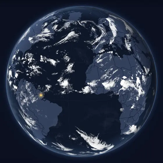
Clouds over the whole planet from geostationary weather satellites, updated every hour, with the line between day and night drawn where it is right now.
Right now
What you are looking at
The picture is stitched from the infrared images of the weather satellites that watch the Earth from 36,000 km up. Infrared sees clouds by day and night alike, so storms, fronts and the swirl of a hurricane are there at any hour. The darker half of the map is the night side, moving west as the Earth turns.
How to read it
- Brighter white is colder, higher cloud — the tops of storms; faint grey is low cloud and fog.
- The shaded side is night; the edge is where the Sun is just rising or setting.
- Turn the globe to follow a storm, or switch to a flat map to see the whole world at once.
Where the data comes from
NOAA GMGSI (Global Mosaic of Geostationary Satellite Imagery), infrared, hourly. The night side is calculated for the minute.
Questions
- How often is the cloud map updated?
- NOAA publishes a new global mosaic every hour; Kartavera checks for it every fifteen minutes and shows the newest one, with the time it was taken.
- Why can I see clouds at night?
- The satellites measure infrared, the heat that clouds give off, which does not need sunlight. That is why the map looks the same by day and by night.
- Are the poles missing?
- Geostationary satellites sit above the equator, so they see the far north and south at a very low angle; the picture fades near the poles.