Eritrea at its true size
Eritrea covers 117,600 km², number 99 of 194 countries by area. Home to 3,607,003 people (2025). Sitting near the equator, it is one of the few places Mercator gets almost right.
Equal-area projection · Natural Earth 50m
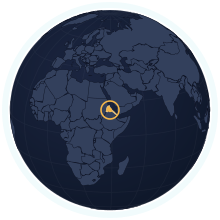
| Area | 117,600 km² Wikidata |
|---|---|
| Population | 3,607,003 World Bank, 2025 |
| Density | 31 per km² |
| Capital | Asmara |
| Local time in Asmara | |
| Time zone | UTC+3 IANA |
| Currency | Nakfa (ERN) Wikidata |
| Languages | English, Arabic, Tigrinya |
| Traffic | On the right |
| Region | Eastern Africa, Africa |
| Status | Independent state |
| Coast | Has a coastline |
| Calling code | +291 |
| Codes | ER · ERI · 232 |
Weather in Asmara now
Now
—Loading the forecast…
The next three days
Weather data: MET Norway (CC BY 4.0), updated hourly · Temperatures on the map
Where Eritrea ranks
Among the independent states, in 33 rankings. Each links to its table.
People
- Population#130 of 1943.6 million people#40 of 54 in Africa
- Population density#150 of 19431 people per km²#40 of 54 in Africa
- Urban population#161 of 19235% urban#40 of 54 in Africa
- Fertility rate#36 of 1923.68 births per woman#33 of 54 in Africa
- Population growth#48 of 192+2.00% a year#36 of 54 in Africa
- Birth rate#36 of 19228.7 births per 1,000 people#34 of 54 in Africa
- Death rate#140 of 1926.0 deaths per 1,000 people#40 of 54 in Africa
- Children under 15#37 of 19237.6% under 15#33 of 54 in Africa
- People over 65#137 of 1924.3% aged 65 and over#12 of 54 in Africa
- Net migration#142 of 192−1.9 per 1,000 people#41 of 54 in Africa
- Refugees abroad#3 of 190153.84 refugees abroad per 1,000 people#2 of 54 in Africa
Health & education
Economy
- Internet users#180 of 18414% online#48 of 52 in Africa
- Unemployment#71 of 1786.0% of the labour force#27 of 53 in Africa
- Jobs in agriculture#16 of 17855.5% of jobs#15 of 53 in Africa
- Jobs in industry#147 of 17812.7% of jobs#32 of 53 in Africa
- Jobs in services#163 of 17831.8% of jobs#41 of 53 in Africa
- Mobile subscriptions#177 of 19159 subscriptions per 100 people#46 of 54 in Africa
Energy & environment
- CO₂ per person#167 of 1850.22 tonnes a person#38 of 53 in Africa
- Forest area#145 of 19212% forest#37 of 54 in Africa
- Renewable energy#15 of 19080.7% renewable#13 of 54 in Africa
- Access to electricity#169 of 19255.3% with electricity#33 of 54 in Africa
- Air pollution (PM2.5)#36 of 19133.7 µg/m³#20 of 54 in Africa
- Protected land#188 of 1910.0% of the land protected#53 of 54 in Africa
- Arable land#124 of 1905.7% of the land arable#33 of 54 in Africa
- Water stress#87 of 17611.2% of its available fresh water#21 of 53 in Africa
- Precipitation#150 of 180384 mm a year#40 of 54 in Africa
Governance & safety
Countries of a similar size
Every country within 25% of Eritrea’s area, lit up on the map →
- Malawi0.99×Eritrea and Malawi are almost exactly the same size.
- Nicaragua0.98×Eritrea and Nicaragua are almost exactly the same size.
- Benin1.02×Eritrea and Benin are almost exactly the same size.
- North Korea0.98×Eritrea and North Korea are almost exactly the same size.
- Honduras1.05×Eritrea is 5% larger than Honduras.
- Liberia1.06×Eritrea is 6% larger than Liberia.
How many times does Eritrea fit into…
- Russia: about 145 times
- Canada: about 85 times
- United States: about 84 times
The land itself
Rivers, summits and lakes Eritrea shares with the rest of the world. Turn on “Rivers & lakes” and “Physical names” in the atlas to see them on the map.
Rivers
- Tekezé608 km
Summits
- Emba Soira3,018 m
- Ramlo2,248 m
- Mousa Ali2,028 m
Rivers are listed by the published length of their whole course, not the part inside Eritrea. Figures from Wikidata, features from Natural Earth.
Neighbours
Questions about Eritrea
- How big is Eritrea?
- Eritrea covers 117,600 km², which makes it number 99 of 194 countries by area. About 3,607,003 people live there (2025), 31 per km².
- Is Eritrea bigger than Malawi?
- Eritrea and Malawi are almost exactly the same size. Eritrea: 117,600 km²; Malawi: 118,484 km².
- How much does the Mercator map distort Eritrea?
- Eritrea lies close to the equator, so Mercator draws it at nearly its true size. It is the countries far from the equator that Mercator inflates.
- Which countries border Eritrea?
- Eritrea shares a land border with Sudan, Ethiopia, Djibouti.