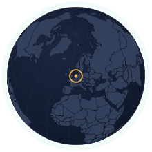
Netherlands at its true size
Netherlands covers 42,201 km², number 131 of 194 countries by area. Home to 18,087,633 people (2025). A Mercator map draws it about 2.67× too large.
Equal-area projection · Natural Earth 50mRemote islands and overseas parts not drawn; the figures include them
| Area | 42,201 km² Wikidata |
|---|---|
| Population | 18,087,633 World Bank, 2025 |
| Density | 429 per km² |
| Capital | Amsterdam |
| Local time in Amsterdam | |
| Time zone | UTC+1, summer time UTC+2 IANA |
| Currency | Euro (EUR) Wikidata |
| Languages | Dutch |
| Traffic | On the right |
| Region | Western Europe, Europe |
| Status | Independent state |
| Member of | EUNATOEuro areaSchengen AreaOECD |
| Coast | Has a coastline |
| Calling code | +31 |
| Codes | NL · NLD · 528 |
Weather in Amsterdam now
Now
—Loading the forecast…
The next three days
Weather data: MET Norway (CC BY 4.0), updated hourly · Temperatures on the map
Where Netherlands ranks
Among the independent states, in 44 rankings. Each links to its table.
People
- Population#72 of 19418 million people#10 of 44 in Europe
- Population density#21 of 194429 people per km²#5 of 44 in Europe
- Urban population#8 of 19296% urban#3 of 43 in Europe
- Fertility rate#151 of 1921.43 births per woman#17 of 43 in Europe
- Population growth#125 of 192+0.52% a year#14 of 43 in Europe
- Birth rate#154 of 1929.2 births per 1,000 people#13 of 43 in Europe
- Death rate#43 of 1929.6 deaths per 1,000 people#27 of 43 in Europe
- Children under 15#165 of 19214.9% under 15#21 of 43 in Europe
- People over 65#24 of 19220.9% aged 65 and over#23 of 43 in Europe
- Net migration#15 of 192+5.8 per 1,000 people#7 of 43 in Europe
- Refugees abroad#155 of 1900.01 refugees abroad per 1,000 people#24 of 41 in Europe
Health & education
- Life expectancy#29 of 19282.0 years#20 of 43 in Europe
- Infant mortality#159 of 1913.4 infant deaths per 1,000 live births#15 of 42 in Europe
- Doctors#34 of 1783.88 doctors per 1,000 people#24 of 41 in Europe
- University enrolment#15 of 14586.6% gross enrolment#7 of 43 in Europe
- Human Development Index#8 of 190an index of 0.955#7 of 42 in Europe
Economy
- GNI per capita#10 of 185$68,530 a person#7 of 41 in Europe
- Internet users#17 of 18497% online#10 of 43 in Europe
- GDP per capita (PPP)#10 of 184$87,320 a person#5 of 41 in Europe
- GDP growth#137 of 187+1.8% a year#21 of 42 in Europe
- Inflation#86 of 176+3.2% a year#21 of 40 in Europe
- Unemployment#114 of 1783.9% of the labour force#29 of 39 in Europe
- Extreme poverty#126 of 1490.1% under $3.00 a day#27 of 39 in Europe
- Income inequality (Gini)#142 of 149a Gini index of 25.7#34 of 39 in Europe
- Jobs in agriculture#161 of 1781.7% of jobs#33 of 39 in Europe
- Jobs in industry#145 of 17813.8% of jobs#37 of 39 in Europe
- Jobs in services#4 of 17884.5% of jobs#2 of 39 in Europe
- Foreign investment#154 of 1840.3% of GDP#30 of 41 in Europe
- Exports#12 of 16880.7% of GDP#6 of 40 in Europe
- Military spending#52 of 1552.2% of GDP#17 of 39 in Europe
- Mobile subscriptions#54 of 191129 subscriptions per 100 people#16 of 43 in Europe
Energy & environment
- CO₂ per person#34 of 1856.60 tonnes a person#10 of 37 in Europe
- Forest area#153 of 19211% forest#40 of 43 in Europe
- Renewable energy#130 of 19012.2% renewable#35 of 41 in Europe
- Access to electricity#1 of 192100.0% with electricity#1 of 43 in Europe
- Air pollution (PM2.5)#164 of 1918.6 µg/m³#31 of 42 in Europe
- Protected land#60 of 19122.9% of the land protected#20 of 42 in Europe
- Arable land#29 of 19029.8% of the land arable#13 of 42 in Europe
- Water stress#72 of 17616.7% of its available fresh water#13 of 38 in Europe
- Precipitation#108 of 180778 mm a year#17 of 37 in Europe
Governance & safety
Countries of a similar size
Every country within 25% of the Netherlands’s area, lit up on the map →
- Denmark0.98×Netherlands and Denmark are almost exactly the same size.
- Switzerland1.02×Netherlands and Switzerland are almost exactly the same size.
- Estonia0.93×Netherlands is 7% smaller than Estonia.
- Bhutan1.1×Netherlands is 10% larger than Bhutan.
- Dominican Republic0.87×Netherlands is 13% smaller than Dominican Republic.
- Slovakia0.86×Netherlands is 14% smaller than Slovakia.
How many times does Netherlands fit into…
- Russia: about 405 times
- Canada: about 237 times
- United States: about 233 times
Neighbours
Questions about Netherlands
- How big is Netherlands?
- Netherlands covers 42,201 km², which makes it number 131 of 194 countries by area. About 18,087,633 people live there (2025), 429 per km².
- Is Netherlands bigger than Denmark?
- Netherlands and Denmark are almost exactly the same size. Netherlands: 42,201 km²; Denmark: 42,925 km².
- How much does the Mercator map distort Netherlands?
- At about 52° latitude, Mercator stretches Netherlands to roughly 2.67× its true area relative to a country on the equator. Kartavera draws it in the Equal Earth projection, where areas are exact.
- Which countries border Netherlands?
- Netherlands shares a land border with Germany, Belgium.